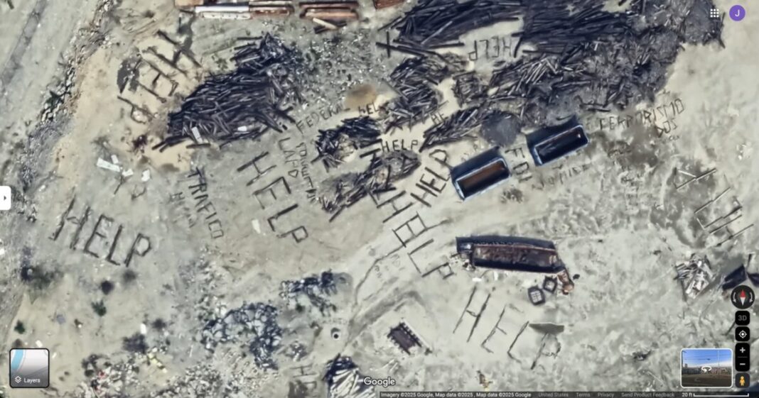
The online community is in a frenzy after recent satellite images disclosed several distressing ‘HELP’ signs constructed from debris in an undisclosed location in California.
The coordinates, pinpointed at 34°03’18″N 118°13’30″W, have sparked a flurry of speculation and concern among internet sleuths and conspiracy theorists alike.
These images, captured via Google Earth, reportedly first surfaced between September 2022 and June 2023. They depict large-scale signs clearly visible from the sky that spell out “HELP.”
Additional elements in the images suggest ominous undertones, with words like “TRAFICO,” “FBI,” “LAPD,” and “TERRORISMO” also pieced together nearby.

A curious Los Angeles resident, driven by the growing online hysteria, ventured to the site to verify the claims.
His findings…


